Showing posts with label hikertrash. Show all posts

Saturday, May 9, 2015

Day 10: the Lower Gila

5/2
Day: 10 mile 14.5-35.3 Marie Hot Springs (on Gila Alt route)

Miles: 20.8 (but definitely more in real life!)

Total trip miles: 187.3

I woke up knowing it was almost 24 miles to Doc Campbell's, my next resupply. This is my favorite kind of place to resupply, I think it's sort of a convenience store/resort type place. It's a town day with only half stress. Because all I can do all day is get my package of food, eat homemade ice cream, sit in hot springs and check wifi. Silver City was awesome but I spent half the time walking around. Compact little places are the least stressful town days. Originally I thought I might try to camp a mile or so outside of the resort, then I found a hot spring only three miles away. It was perfect, 21 mile day and then almost a whole day off. 

When I woke up no one else was moving and I felt guilty but backpacking gear is so crinkly and loud! By the time I left Thatch and Rafiki looked like they were almost ready too and Bigfoot and Moist were still in their sleeping bags. So I was guessing my hike would be another solo one. 


It started out great, steady downhill in a creek canyon through forest. The trail was super rocky and even when it was a road I found myself tripping all over the place for the first miles. The trail got steadily steeper, it's hard to explain but right now I tend to walk 2.5-3 miles per hour. I was barely getting 1.5, but as I descended into the canyon I could see the Gila River. I had finally looked at my map and it looked like once I reached the river I would be following it the whole day. 


Rocky steep trail

Elevation profile heading down (courtesy of Guthook app)


I finally made it down and was so excited. I've been hearing about this section for ages and it's totally worth the alternate. The rocks and the river are so different than the first 150 miles. They are amazing in their own right. 


And so I spent my day crossing back and forth over the river. My feet were wet all day and I easily crossed over 20 times (later this week it will be 85 in a section!). The whole thing is beautiful with towering cliffs, lush green trees everywhere and I even got ominous clouds to occasionally give me some shade. 


One of the highlights of the day was accidentally scaring a group of I think Javelinas (or wild pigs?). I came around a corner and saw one, it grunted and then like a porcupine it's back seemed to totally poof out and it went leaping away, I was so surprised when at least 4 or 5 others started grunting and puffing out and headed towards the hills. It was a great day for lizards and butterflies too. 


But I'm not going to lie, it was tough going. There was some trail but often it was just wandering along very rocky or sandy areas full of spiky bushes and tree branches hoping I might see a cairn marking the trail. In the beginning the water crossings were usually only ankle to knee deep. After my lunch break they tended to be crotch deep, thankfully not too cold at all. It was fun and exciting but I was feeling the miles. When I got to where the hot springs should be I collapsed and peeled off my wet shoes. After a nice break I went searching. Across the river up under to cliff I found them. They weren't particularly hot but they were still pretty nice. I'm tired and happy to be done hiking for the day. 


The wind is starting to pick up and the ominous clouds are still lurking, plus I'm camped in low spot. 
Something tells me I'm not making it through the night dry. But hey, I have plenty of time to dry stuff tomorrow. 

I propped my neon pack on the top of the riverbank so the folks right behind me might stop if they were looking. Turns out it worked perfectly, first Moist, then Bigfoot and even Thatch said they saw the pack and crossed the river to check it out. The only one who missed it was Rafiki, oh well. We'll all have hot springs tomorrow. 

Sunday, May 3, 2015

Day 8: Silver City you are one rad town

4/30
Day 8: mile 130.1-144.5 Silver City 
14.4 miles 

I had big plans, I was so close to highway 90 that I wanted to wake up nice and early and do as much of my 12.5 mile road walk in the cool of the morning as possible. Road walks can be tough, especially paved big roads. The cars zooming past can be a little overwhelming and pavement for that long is tough on your feet. Plus the shade is pretty minimal. 
So when my I alarm went off I knew all these things but it was so cold out! So I stalled for a bit and finally packed up and headed down Tyrone Rd. Easy walking and then onto the highway. A nice big climb to start out, most of the views in the beginning were just of Tyrone Mine, apparently a giant copper mine. 


Nothing too exciting, and it was getting hot as I got closer to town. 


Not quite. More like 8 miles but I think these have something to do with the bike race. 

As I was walking down the highway I watched a guy on a bike turn around and cross the highway. He pulled up and immediately asked if I was a CDT hiker and needed a place to stay. So with directions and names it was looking like I might actually spend the night in Silver City. 

Just a few minutes later a search and rescue car pulled over next to me. But it was just a very nice lady named Wendy. Welcoming me to town and saying the worst part of the road walk was almost over. 

This bridge will be demolished 5/5, new trail will follow as construction continues 

Silver City was overwhelming, I had no idea where to start. The first thing I saw was a historical site about Billy the Kidd. 


Then I stopped in at the Visitors Center (bathrooms, water and wifi!) and then the post office. I was hoping for a hiker box but no luck. 

Still circling I stopped at the two bike shops to look for some gear and got another offer for a place to stay and then headed to the local coop to resupply. So many errands I was just ready for a break. 

I was heading down the street when Thatch appeared and when we turned the next corner there was Rafiki. Lots of stories and a long lunch were perfect. Thatch made the same mistake as me yesterday only he followed the trail farther until it just disappeared and then turned around and retraced his steps unlike me who decided to cross country. Either way nice to know yet again I am not alone. 
This mural is amazing, I think the Harry Potter is maybe my favorite 


New hiking shirts

We wandered in circles doing errands and finally stopped in at the bike haus. What a cool house, guess it's famous in certain circles but a perfect bit of trail magic. 


Doesn't your house have a puppet loft? 


Sitting around tired and so hot. Chatting with the some of the guys at the Bike Haus and just general nonsense. We headed back to town (so much walking during our down time!) and stopped in at the brewery and found so many hikers. 


Lots of chaos and updates then more food and even more wandering and people. Finally back to the house and sleep.
The house is less than 0.3 miles to the trail and after how hot today was I'm hoping for an early start tomorrow. 

Thursday, April 30, 2015

Day 7: CDT, PCT style

4/29
Day 7: mile 106.9-130.1 total miles, I'm honestly not sure maybe 26? But officially 23.2)

This post is long but a whole lot somehow happens even when you're just walking all day. 

Today was pretty great. I think I have Thatch to thank for that. Moods are contagious and he was so happy last night that it definitely rubbed off. 

I woke up to a chilly morning and my sleeping bag covered in frost yet again, oh well at least stuff dries out here super quick. I packed up and headed out. The only water until Silver City was 15 miles away and I've decided to add at least an hour to my planned hiking everyday assuming I'll get misplaced from the trail so time was a wasting. 

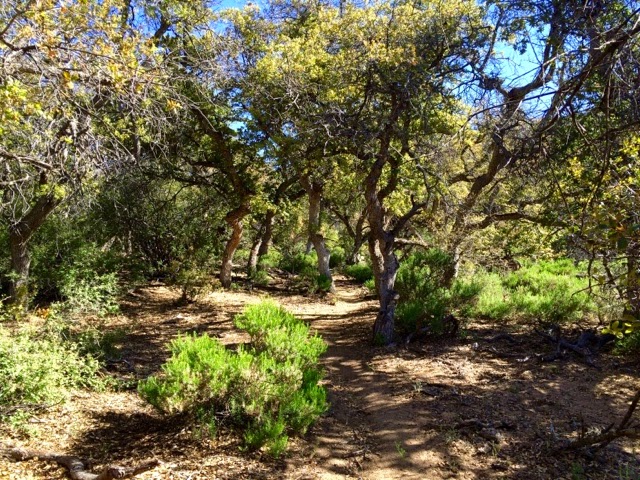
The morning was great, cruising up and down the trail I felt like I was back in the East Bay, it almost looked like oak woodlands except for the occasional cactus. It was so beautiful with the ever increasing trees and the gentle climbing brought some pretty decent views. 


I came to the Burro Peak trailhead and found my first official trail sign which was cool. 


And then I started climbing, I stopped and checked my maps and then the elevation profile I had. I had this vague memory of no climbing the first 200 miles. Nope, way wrong. I was in for over 2000 feet of gain, up over 8000 ft. Which for a frame of reference is about where Mammoth is (South Lake Tahoe is only 6 something). But man was it fun. That was my first big climb in awhile and it was hard but great. The first peak had these cool old ruins and the second felt just like Tahoe. Very trippy. I made it to the top faster than expected and met Porscha and JW (I think those were there names). Chatted and then headed 2 miles down to the water source. 


Muddy spring wasn't bad, my first official natural source on the trail, and nice and cold. I killed a few hours with the other two hikers and Rafiki showed up. I expected Banana Pants and Thatch but either way we'll all be in town tomorrow. 


The big debate was which way to go. The maps literally had this section marked as confusing intersection and said just head down the canyon and ignore the  new signs because the trail would dead end. But in Lordsburg we had been told the trail was finished. Plus the number of trails and signs in real life and on the map didn't match. 

The couple took one way and I headed the other. I of course lost the trail about a mile in. But everything sort of clicked and I had no trouble figuring out where I needed to be. I was having a great time and found a real live stream and slid under some barbed wire only to realize I was on actual private property. I high tailed it out right quick, you know what makes for great stealth trespassing, not my neon backpack. Quick enough I popped out and found myself right in front of a CDT sign, awesome! 


And then Tyrone Rd which was exactly where I meant to be. Only I didn't check my GPS and just blithely followed the signs. I thought something was off but I didn't investigate. When I did finally check the GPS I was 1.6 miles off trail. But how was that possible, I was staring at a CDT sign? So this is actually a new section of trail that just opened this week that I don't have the maps or mileage for. We had talked about it in Lordsburg but I couldn't remember, it was either 2 or 13 miles longer than the trail I had meant to take. I acted a little rashly and instead of just turning around I headed down a road that wasn't even on my map. I was thinking was roads are easier than bush whacking down canyons and this way I could try to cut back to Tyrone Rd. And so I headed down into what was officially called Mystery Canyon, with the biggest mystery being what the heck my plan was. Needless to say I eventually ditched the road and bushwhacked my way up and over 2 smaller ridges and then up a creek to connect to another road that eventually lead to Tyrone Rd. And so after 2.5 hours I had officially gone about half a mile. Whoops. Honestly I actually had a lot of fun. I saw an only abandoned mine and a mini waterfall, beautiful trees and most importantly while I wasn't where I want to be I never felt truly lost. I'm slowly getting the hang of this finding your way back to the trail thing. Now I just have to work on not losing it in the first place. 


Tomorrow is Silver City. I had originally thought to spend the night or maybe even take a whole day off if I felt like it but it turns out this weekend is some giant bike race. I believe Tour of the Gila?  Either way it sounds like rooms are super hard to come by. So unless someone who called ahead wants to share I'll probably just walk a mile out of town. My stop after Silver City is only about 50 miles further and had a resort with hot springs which is sounding like a way nicer option anyhow. 


Now to sleep. I have a little bit to the highway and then 12.5 miles walking next to highway 90 to get to town. 

Day 6: the Forest! Well sort of

4/28 
Day 6: mile 84.5-106.9 (22.4 miles)

Today I felt a little cranky and off all day. I think it was mostly due to too little sleep which just made everything just that much harder and me even crankier. 

The day started with breakfast at the motel, and talking with the people getting ready to leave on today's shuttle which was fun. Thatch had to go to the post office to mail his resupplies and I hate hiking in afternoon heat so I took off. It looks like everyone at the hotel was planning on taking off at some point today so this section might be crowded. 

The trail heads straight down Main St through Lordsburg. 


Then the even more scenic highway 70 for 2 miles. Finally turning off highway 90 and heading cross country. 


This was the start of my trouble. First you slide under the barbed wire, no problem. Then do you see the short dark marker next to the bush on the far right of the sign? Yeah nice and obvious huh. I was about to spend 10 miles in blasting cold wind walking across this nonsense. 


I of course ended up way too far south a mile below the "trail" and found my way back to the route walking under a telephone wire track. Very glamorous. 


See the posts? Yeah I certainly didn't. On the bright side most people I talked to in the afternoon didn't either. 


This faint trail saved my sanity. This mostly took me the last 5 miles of cross country. I guess it was the lighting because whenever you turned around the signs were simple to find. 


And then I turned through a beautiful metal gate that meant no more cross country. The trail became a 2 track 4WD road and I officially entered the Gila National Forest. So far it's been all BLM land. It was awesome. The road started climbing and trees were regularly all around. 


Then it was time to play goldilocks with my water sources. Stealthily trying to find water while the cows were away. 


Not too hot or too cold, just not there. 


Way too tricky to get, plus empty too...


And finally just right! There was a pipe dripping into the actual tank so I didn't have to drink cow snot or anything. Plus Hot Springs and Rafiki were there so I killed a fun few hours. Rafiki left but Banana Pants arrived so the hours passed surprisingly quickly. I had been in a great mood since starting the road walk and the long break helped. I had been so frazzled earlier in the day I didn't take any real breaks. 

After leaving Engineer Windmill I officially passed the 100 mile mark. Woohoo, someone even drew this in the dirt. 


It was actually starting to feel a little more like mountains, those roads actually do a fair bit of climbing and it was really fun. 

Then just 3 miles later was Co-op windmill. The nicest one yet! It's funny everyone I've seen today is intentionally hiking solo but likes to be social at campsites and water sources. So you get the freedom during the day but still get to interact with hikers. 


More rolling hills and some climbs and then the most magical thing, official trail. Not roads, or signpost to signpost or weird rock posts but 100 miles + into this thing genuine trail! Steep as all heck but awesome. 


I hiked another hour or so and my foot started hurting for the first time on the whole trip and I started to get all fatalistic thinking this is the end of my hike (dramatic aren't I). I dragged myself a little farther until I found a campsite and tried stretching my foot and calves. Mostly just moping around. And then magically Thatch showed up and he was ridiculously happy, he'd had a great day. So instead of getting bogged down and just going I'm going to make sure I take breaks tomorrow and go a bit slower. We'll see