Sunday, September 15, 2013

Wonderland Trail: Day 3 Sunrise - Indian Bar

The weathermen didn't lie, that was a crazy night. After 8 the rain started in earnest and while it got a little lighter sometime in the early hours it never stopped. I think the thunder and lightning stopped around 2 am but sleep was pretty minimal. I would wake up, stare at the lightning, and my steadily wetter gear and once again look at my watch. At least if I'm hiking I'm doing something.


It was finally light enough to head out. The plan was to get down the 3 or so miles to White River where there was a ranger station and hopefully change up permits so I could have days more to my liking.


That's Rainier, at least as much of it as I was going to see while I hiked down towards White River. I got down there and was surprised to see 4 hikers milling around in the rain. They had camped there the night before and stayed somewhat dry sleeping on the porch of a building. Man was I jealous. After chatting trail for a bit one of the guys turned out to be a section hiker and offered me a lift to the Ranger Station. After stalling for a bit James and Steph showed up and both James and I ended up getting a ride. I thought the station was 0.5 miles away, nope way farther than that. I was super glad for the ride and the rangers were very accommodating. We both were able to make at least one change to our permits. Back in the car and after a bit more repacking back on the trail.

Looking up the White River
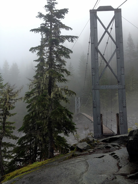
Apparently the bridge over White River had just been completed the day before. So we got to avoid a mile and a half road walk and enjoy a brand new bridge. That's one raging river, glad to be the first to enjoy a great new bridge.


And then it was time to climb. I've heard that the very best camps along the trail are Summerland and Indian Bar. Lots of people even recommend a very short day as the two sites are only 4.5 miles apart just so you can stay at both spots and enjoy what many swear are the best views on the mountain. My hike would take me up 2000' to Summerland and then up another 1000' to Panhandle Gap and then all the way down to Indian Bar. I was crossing my fingers that I would get at least a few glimpses of the supposedly spectacular scenery.

mountains peeking out

waterfalls as I climbed


and the trail heads somewhere up there, looking out from
Summerland
Summerland seemed nice. The sky cleared just enough for me to get a peak of where I was headed and within 5 minutes I could once again see only a few feet in front of me. There is a shelter at the campsite and I took a short breather and snack break as I chatted with another hiker. The climb was definitely a long one and it was a much appreciated break from the rain under the small roof.

Looking back towards Summerland

and Summerland is eaten by a cloud
The trail enters rockier territory, passing giant glacial creeks and looming ridges. I couldn't believe my luck. Was that a spot of blue sky? Would I actually be lucky enough to see a bit of what surrounded me? I'll admit the blue spot made me giddy and after taking about a zillion pictures I pretty much skipped up the rest of the mountain.


negligible snow, easy time over the ridge
and it's gone...
over the top and into the mist
As I traveled on I passed over countless streams, through meadows filled with the small flowers and an abundance of marmots. Occasionally I would glimpse snowy shapes on my sides but I'm really not sure what the heck I was looking at.

marmot traipsing across the land
The trail made one last jump up and after a short snowy pass it was back down I went. I could hear thundering water but see nothing. You could tell where people stepped off for viewpoints by well trodden bare spots but I only saw white.


It felt like I was heading down the spine of a ridge but I'm not sure.


Down and down the trail went, wet and mysterious I felt like I must be getting closer. I was in a hurry to get to basically no where so I took my time. Mumbling songs like here comes the sun and I've got high hopes. There were also about a million delicious berries which caused me to stop every few minutes, in other words a slow trek down.


And then I was at the bottom. My knees thanked me and I dreamed of setting up my gear and drying even a fraction of my stuff. I was dripping wet and walking along a glorious river on Mt Rainier. I was enjoying my day a surprising amount but definitely tired. I headed up to the campsites and very slowly trudged around. Those campsites are spread out! And required way more climbing than I felt up to. I finally picked a spot and set up my tent in the drizzling endless rain. I picked the biggest spot I could find because Steph and James were planning to camp with me. While we had been able to make a few changes to our permits nothing had been available that night and the ranger had said it would be just fine for them to camp with me. So I needed space for 2 tents. 

Finally there
I paced around, ate some berries and got impatient. I was simply to wet to want to hang out in my tent and bored hanging out alone so I decided to explore. Across the river was the group site, shelter included. I thought maybe whoever was staying there for the night would let me hide under its roof for a bit. The group sites are part of the reserved system too, so no first come first serve luck. Just crossed my fingers and hoped they were friendly.


Don and Dave were sitting in the doorway. Turns out they had the same thought as me, but had found the place empty. We decided to kill time and beg the group to let us stay when they got there. An hour or so later James and Steph stumbled in looking pretty rough. They were cold and beat, apparently they got no small break of blue sky and uplifting spirits and were pretty down. Steph didn't even talk the first hour she was so worn out. Finally warming up a bit and spreading out gear at 7 pm we decided to call it, no one was coming and we were staying in that shelter. 


It was glorious. The fireplace was built over but it was still dry after an entire day of rain. It was fun spending time getting to know folks, Dave and Don have decided I should have a second career as a motivational speaker. Apparently I was still obnoxiously cheerful after such a hard day and seemed genuinely happy to be on the mountain which no one else could figure out. The other 4 were all plotting how to bail. I  was still hopeful, the storm was supposed to clear sometime in the early hours and I was praying for sunrise.
Honestly I had a great day. My gear was wet, my shoes were literally dripping water the entire day but I was grinning like a loon. The marmots made me smile, I loved the climbs and even in the mist it was all gorgeous. I am so lucky to be out here, not even a chance I'm bailing. 

Friday, September 13, 2013

Wonderland Trail: Day 2 Cataract Valley - Sunrise

My permit said I was headed to Granite Creek for the night which meant I only had to go 12 miles. The elevation profile showed a bit of down, a massive 3000' climb, a big descent and then another big climb. I had heard flat was basically nonexistent on this trail and it sure was seeming to work out that way.
There had been some thunder overnight and I had seen a few flashes of lightning, interspersed with light rain all night. I had lots of condensation in my tent and the beginnings of a puddle (nothing like camping on a super hard packed surface). So the night was spent desperately trying not to touch my tent walls and packing up was a very damp affair. Looking out into the world from my tent I saw mostly mist, but a small square of blue sky had me hopeful.


officially on the trail now...


very cool suspension bridge
(I believe over the Carbon River)

handy, but man does that thing sway
look the carbon glacier!
Oh wait no I can't actually see it at all...

The climb after the Carbon River was no joke. All I could hear was rushing water and I saw a whole lot of white. I did manage to get squeaked at by a number of pika's which was pretty entertaining and eat y fair share of huckleberries. Long ways to the top for sure, I talked with a couple I had met the day before at Cataract, they had ended up a bit farther than me at Dick's Creek. They said they were headed to Granite Creek to so it looked like I knew at least two of my neighbors.


It sure felt like I was climbing big mountains but its always nice to catch a glimpse of where you are, yup big mountain. No Rainier though.


Over the top of the ridge line and down towards Mystic Lake, and gloriously sunny breaks in the clouds.


Mystic lake was an especially nice treat because the sun broke through the clouds for a good 15 minutes. I stopped to eat and unfortunately was completely chilled and back in a cloud before I had finished even one tortilla. 

Crossing Winthrop Creek was neat. Very otherworldly trek through mist and crashing water. Loud and strange.


Back to climbing and my first actual look at a glacier up close. The Winthrop glacier is right on the trail as you head up toward Granite Creek. 


More misty climbing and then it was 1 pm and I was at camp. Hmm okay then I guess an early day? I set up my tent and lay out my stuff. It had stopped drizzling and even though there was no sun I thought maybe stuff might dry at least a little. As I was sitting there puttering around the couple I had met the day before arrived. We had passed a ranger on the climb and while I had just chit chatted they had thought to ask if they could change their campsite to a farther one so their day could be longer. Darn why didn't I think to ask? Apparently with the weather folks were cancelling their permits and sunrise had an open spot for them. An extra 5ish miles but at 1 pm that's almost perfect. They invited me along to share their campsite, they figured no harm in having two tents in one site. I said I would meet them there as they headed up the trail and I crammed all my stuff right back into my pack.
As I made it to the ridge I felt like I was missing some great scenery. It seemed like a perfect place for epic views, rocky and open but I saw white...

best view of Rainier all day...
Some insane lucky moment had the sky clearing just a bit as I made it up the ridge toward Frozen lake. Look mountains!


Up on the ridge was a large group of people. At least 7 or 8 of them huddled around talking. Turns out they were a group out on a guided trip. As I was talking to them the PCT came up and one of them said, oh wait one of our guides hiked last year too! The guide turned to me and laughed saying I probably had no clue who she was, but it was Threshold! Oh the small world of the PCT and the internet. We had exchanged a few words online and while I never hiked with her I definitely knew who she was. It seemed perfect that I had left Granite Creek and had gotten to see all these lovely ladies. 

looking down toward Sunrise Camp


The place was pretty empty and after setting up camp I decided to walk over to the Sunrise Ranger Station/trail head with Stephanie and James. That was the closest water and they had cached food there plus I had heard rumors of a hiker box. Its always fun swapping food and I was curious what the place looked like. As far as the food caching goes you can mail stuff to the park or physically drop things off at multiple locations along the trail. Lack of planning (must be mailed 2 weeks in advance) and an incredible lack of desire to drive any additional distances meant I was carrying all my food. So we headed off on what felt like a very long gravel road (its actually just a little less than a mile from the campsite but whatever). Basically landing me a 19 mile day, not to shabby.
Sunrise is pretty nice. There is a giant lodge, a visitor's center that closed for the season 9/1 and a few other buildings including a giant bathroom with running water and hot hand dryers (ah the luxury when its cold and damp outside) and a big metal box full of people's food caches and a hiker box. The weather report tacked to the info board says over 4 inches of rain tonight, lovely. After loitering a bit and grabbing some snacks (chocolate peanut butter and a mountain house dinner, why yes thank you) we headed back. The sky was becoming more ominous and while it wasn't actually raining thunder started rumbling around 6pm and was putting everyone on edge. I spent the rest of the evening hanging out with Threshold's group talking about hiking and plotting future CDT plans. At 8 it finally started to rain and get dark, my cue to huddle in my tent and pray for better weather.

Thursday, September 12, 2013

Wonderland Trail, Day 1 Mowich CG - Cataract Valley

I woke up cramped and disoriented. I grumbled about paying for a campsite I used for less than 6 hours but figured Karma's a bitch so I sucked it up and headed towards the park. The sun was blinding and with actual daylight I was able to get my first look at the park. I of course showed up over 30 minutes before the permit station opened but that was plenty of time to scope out where the heck everything was, Longmire is quite the village. Into the office I finally went flinching when I saw the posted weather report and crossing my fingers when I asked about a walk up Wonderland Trail trip. No worries the lovely ranger said, here's a map and here's what's already full the next few days. Well shoot that was more decision making than I actually wanted on very little sleep. I was hoping for a "oh, this is where you should go" moment. After staring for quite some time and realizing my two potential starting points of Longmire or Sunrise looked pretty impossible due to the surrounding sites being full the ranger took some pity on me. Most plans I had read about seemed to start at Longmire or Sunrise, although you can start at pretty much anywhere the road hits the trail (at least 6 or 7 options).  I hadn't even considered any of the other options.

not my itinerary but you get the idea

basically 4000-6000' elevation gain daily at a minimum
After the brilliant suggestion (really this turned out to be fantastic advice) to start at Mowich Lake Campground I was able to cobble together a 7 day trip. Clockwise or counter clockwise didn't matter much to me, there's burly climbs no matter which way you swing it. Clockwise ended up being the name of the game and once I had a starting point it was fairly easy, I even nabbed Indian Bar which is apparently one of the prime sites on the whole trail. I was warned that I had a few challenging days but I figured the low mileage ones evened those out and wasn't too worried. After assurances that my car would be fine on the dirt/gravel road to Mowich and getting directions for the 2 hour drive that would be required to get me there I took one more glance at the weather and headed out. Apparently I was in for thunderstorms that evening, heavy rain Thursday 9/4 and then clearing Friday. Heavy rain might be awful, but those weathermen always seem to be exaggerating anyhow. More crossed fingers...
An hour plus later I took the turnoff and headed onto a gravel road that wound up the mountain for what felt like ages. I sorted out 7 days of food, which I of course had not done yet and at 1130 finally started walking.
The Wonderland Trail has at least one alternate route that I had read was prettier than the official trail and that's exactly where I started. I only had 6.5 miles to go to get through the Spray Park alternate to my official campsite at Cataract Valley. The alternate isn't on the elevation profile and with only my free park map in hand (no topo on that thing) I basically had no clue what I was in for.
It didn't matter, it was so pretty the giant climb was insignificant because I took pictures about every two minutes.


first few forested steps


water absolutely everywhere

worthy side trip to falls 
I think this was my first view of spray park


Rainier hiding was soon to become a theme for the first half of my trip...


As the trail climbed up higher towards the ridge line I was treated to views of Rainier, wildflowers, huge mountains and mushrooms of all types. Not to shabby a start.


Once I reached the first plateau I think I had a grin plastered on my face for a good two hours.


Up and over, only a small bit of snow to navigate, and then down into the mist.


And it was quite the descent. Once I was enveloped by the clouds it was mostly mushrooms and flowers occupying my view.


I made it to my campsite nice and early. Set up my tent and proceeded to hide from the drizzle and nap. I eventually made friends with the other folks camping there but due to the weather it was a pretty quiet evening.

To Mt Rainier!

I often get asked what my favorite section of the Pacific Crest Trail was. For me Washington was the clear winner. Yeah that first day out of Cascade Locks was mostly clear cut and there were some not so fantastic days scattered around, but overall I was in love. I lucked out with weather and views and the people I was hiking near, all combining to leave me with everlasting warm and fuzzy memories of Washington, I'm sure the excitement of almost be finished played a role as well. Whatever the reasons I knew I wanted to head back and explore, so when I managed to snag 10 days off in early September I didn't have to think to hard about where I wanted to go.
I didn't want to repeat the PCT but not being very familiar with the state I asked around, read far to many articles and semi decided on the Wonderland Trail. According to the NPS website the "Wonderland Trail (WT) is 93 miles (150kms) long and encircles Mount Rainier. It is a strenuous hike with lots of elevation gain and loss, through lowland forests and valleys and into high alpine and sub-alpine areas."
I had actually considered hiking the trail a few other times but other trips always got in the way. So it just sort of sat there at the edge of my awareness, one of many trips that might be fun one day. I'd heard that even though it's all on one mountain its a very diverse trail and even more importantly it's a loop, I love a good loop trail. It didn't hurt that it's pretty regularly on hiker's top ten hikes, seemed pretty promising.
So now comes the tricky part, this is Mt Rainier we're talking about. National Parks are the land of permits and a whole mess of rules and fees. The Wonderland Trail is certainly no exception. The trickiest part about the trail is that you can only camp in designated sites and when you get your permit you need a reservation for each night. Which means no on the fly itineraries, good or bad hiking day does't matter, you camp at your designated spot. Plus people try to reserve these permits crazy far in advance (I think reservations open up a year in advance). So my total lack of advance planning meant I would be relying on the beautiful walk up permits, of which there should be 30% available. Tricky thing is if the camps along the way have already been snagged by other walk ups. This all gets very complicated and if you want a great explanation the NPS website is your best bet. I'm pretty darn flexible, I know I can hike long days although the elevation map for this thing is pretty impressive. When researching online 10 and 11 day trips seemed super popular. My days off dictated a  shorter schedule than that what with driving and all but I figured pack a bunch of food and my gear and hope for the best. Worst option, I day hike or do a shorter loop and then head to another park for a few days. Not exactly a hardship. 
My research stopped there a few weeks prior to my planned trip. I looked at the weather a few times, disliked what I saw and chose to momentarily ignore it. Extended forecasts are usually lousy anyway. The night before I left I sat staring at maps making up potential itineraries and scrambling to clean my house. I threw all my stuff in a pile and headed to work. The shift was slow and when they offered to let me leave at midnight I immediately peeled out (labor day pay be darned I was going camping!). I then did all of my grocery shopping which I had stupidly avoided until then (yay for Winco at 1 am), napped for an hour or two and sometime much later than I had intended finally hit the road. 


Very pretty driving but not exactly super short. By the time I hit Eugene, Oregon the sun was starting to set and I clearly wasn't making it to any campgrounds on Rainier in the daylight. I debated motels and other campsites but really wanted to get there so on I drove, I left I-5 and entered the land of misty fog and barely lit roads. It definitely felt like I was heading into the great unknown (the complete lack of cell service did nothing to improve my sense of location).


It then became the debate of the cheapskate versus the coward. After a few wrong turns and debating countless pullouts my inner chicken won out. Apparently when you have been repeatedly told that it isn't safe to sleep on the side of the road this sticks and I finally somehow found the campground right outside the Nisqually Entrance to the park. Angrily glaring at the $18 fee I pulled into the first site sometime after midnight and promptly prepared to fall asleep in the back of my car. It was wet and dark and even setting up my tent sounded too exhausting. The Longmire ranger station was set to open at 0730 and that was my morning goal. So I set an alarm and crossed my fingers one more time to the weather and permit gods and settled in.