Day 7: mile 106.9-130.1 total miles, I'm honestly not sure maybe 26? But officially 23.2)
This post is long but a whole lot somehow happens even when you're just walking all day.
Today was pretty great. I think I have Thatch to thank for that. Moods are contagious and he was so happy last night that it definitely rubbed off.
I woke up to a chilly morning and my sleeping bag covered in frost yet again, oh well at least stuff dries out here super quick. I packed up and headed out. The only water until Silver City was 15 miles away and I've decided to add at least an hour to my planned hiking everyday assuming I'll get misplaced from the trail so time was a wasting.
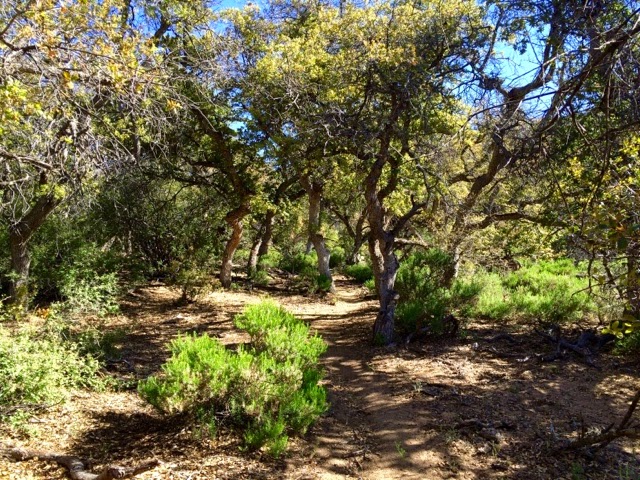
The morning was great, cruising up and down the trail I felt like I was back in the East Bay, it almost looked like oak woodlands except for the occasional cactus. It was so beautiful with the ever increasing trees and the gentle climbing brought some pretty decent views.
I came to the Burro Peak trailhead and found my first official trail sign which was cool.
And then I started climbing, I stopped and checked my maps and then the elevation profile I had. I had this vague memory of no climbing the first 200 miles. Nope, way wrong. I was in for over 2000 feet of gain, up over 8000 ft. Which for a frame of reference is about where Mammoth is (South Lake Tahoe is only 6 something). But man was it fun. That was my first big climb in awhile and it was hard but great. The first peak had these cool old ruins and the second felt just like Tahoe. Very trippy. I made it to the top faster than expected and met Porscha and JW (I think those were there names). Chatted and then headed 2 miles down to the water source.
Muddy spring wasn't bad, my first official natural source on the trail, and nice and cold. I killed a few hours with the other two hikers and Rafiki showed up. I expected Banana Pants and Thatch but either way we'll all be in town tomorrow.
The big debate was which way to go. The maps literally had this section marked as confusing intersection and said just head down the canyon and ignore the new signs because the trail would dead end. But in Lordsburg we had been told the trail was finished. Plus the number of trails and signs in real life and on the map didn't match.
The couple took one way and I headed the other. I of course lost the trail about a mile in. But everything sort of clicked and I had no trouble figuring out where I needed to be. I was having a great time and found a real live stream and slid under some barbed wire only to realize I was on actual private property. I high tailed it out right quick, you know what makes for great stealth trespassing, not my neon backpack. Quick enough I popped out and found myself right in front of a CDT sign, awesome!
And then Tyrone Rd which was exactly where I meant to be. Only I didn't check my GPS and just blithely followed the signs. I thought something was off but I didn't investigate. When I did finally check the GPS I was 1.6 miles off trail. But how was that possible, I was staring at a CDT sign? So this is actually a new section of trail that just opened this week that I don't have the maps or mileage for. We had talked about it in Lordsburg but I couldn't remember, it was either 2 or 13 miles longer than the trail I had meant to take. I acted a little rashly and instead of just turning around I headed down a road that wasn't even on my map. I was thinking was roads are easier than bush whacking down canyons and this way I could try to cut back to Tyrone Rd. And so I headed down into what was officially called Mystery Canyon, with the biggest mystery being what the heck my plan was. Needless to say I eventually ditched the road and bushwhacked my way up and over 2 smaller ridges and then up a creek to connect to another road that eventually lead to Tyrone Rd. And so after 2.5 hours I had officially gone about half a mile. Whoops. Honestly I actually had a lot of fun. I saw an only abandoned mine and a mini waterfall, beautiful trees and most importantly while I wasn't where I want to be I never felt truly lost. I'm slowly getting the hang of this finding your way back to the trail thing. Now I just have to work on not losing it in the first place.
Tomorrow is Silver City. I had originally thought to spend the night or maybe even take a whole day off if I felt like it but it turns out this weekend is some giant bike race. I believe Tour of the Gila? Either way it sounds like rooms are super hard to come by. So unless someone who called ahead wants to share I'll probably just walk a mile out of town. My stop after Silver City is only about 50 miles further and had a resort with hot springs which is sounding like a way nicer option anyhow.
Now to sleep. I have a little bit to the highway and then 12.5 miles walking next to highway 90 to get to town.


No comments:
Post a Comment